
Publications
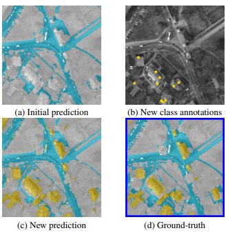
Weakly-supervised continual learning for class-incremental segmentation
G. Lenczner, A. Chan Hon Tong, N. Luminari, B. Le Saux
International Geoscience and Remote Sensing Symposium (IGARSS) 2022.
[PDF] [GitHub] [BibTeX]
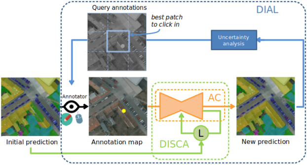
DIAL: Deep Interactive and Active Learning for Semantic Segmentation in Remote Sensing
G. Lenczner, A. Chan Hon Tong, B. Le Saux, N. Luminari, G. Le Besnerais
IEEE Journal of Selected Topics in Applied Earth Observations and Remote Sensing (J-STARS)
[PDF] [GitHub] [BibTeX]
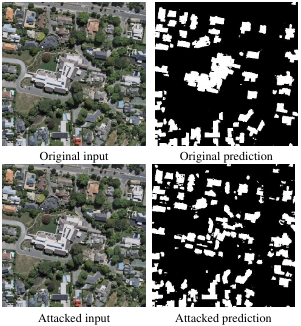
Demotivate adversarial defense in remote sensing
A. Chan-Hon-Tong, G. Lenczner, A. Plyer
International Geoscience and Remote Sensing Symposium (IGARSS) 2021.
[PDF] [BibTeX]
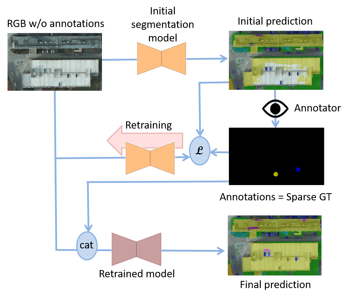
Interactive Learning for Semantic Segmentation in Earth Observation
G. Lenczner, A. Chan Hon Tong, N. Luminari, B. Le Saux, G. Le Besnerais
ECML-PKDD 2020, MACLEAN Workshop. Best Student Paper Award.
[PDF] [GitHub] [BibTeX]
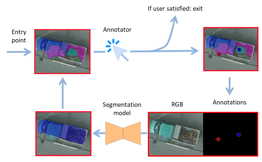
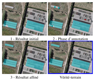
DISIR: Deep Interactive Segmentation with Interactive Refinements
G. Lenczner, B. Le Saux, N. Luminari, A. Chan Hon Tong, G. Le Besnerais
ISPRS Annals of the Photogrammetry, Remote Sensing and Spatial Information Sciences, 2020.
[PDF] [video] [GitHub] [BibTeX]
Segmentation sémantique d’images aériennes avec améliorations interactives
G. Lenczner, B. Le Saux, N. Luminari, A. Chan Hon Tong, G. Le Besnerais
Reconnaissance des Formes, Image, Apprentissage et Perception (RFIAP), 2020.
[PDF] [video] [slides]
Talks
Guided AI for interactive semantic segmentation.
ESA EO Φ-Week, September 2020 [video]
Semantic segmentation of remote sensing images with interactive refinements.
AI4Geo web-seminary, July 2020 [slides]